

Back to the list
La Verne by bike
About
Discover the Massif des Maures by mountain bike and experience a wealth of thrills.
Starting from the Croix d'Anselme parking area, enjoy a descent of approximately 1 km on the RD 14, surrounded by chestnut trees. At the intersection, turn right towards Col des Fourches Gonfaron. At the signpost for "Vallon de Rascas", follow the signs for Valescure and prepare your calves for the climb of approximately 10 km to the signpost for "Cros de Mouton".
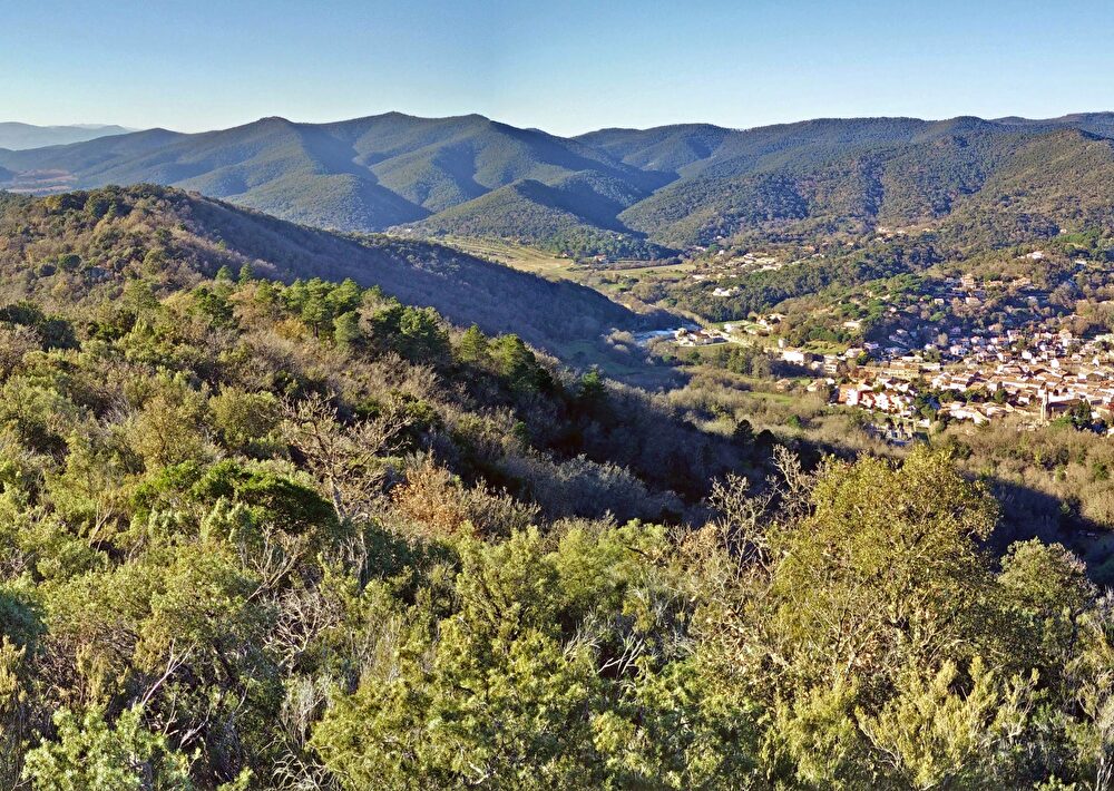
Upon arrival, head towards La Garde-Freinet, continue for 1 km and turn right at the intersection towards Capelude. A rolling 700 m climb on a sandy track leads to the summit of Défens. Here, take a moment to stop and admire the panoramic view over the entire Collobrières forest and the sea.
Get your adrenaline pumping with the next 8 kilometers of downhill riding on
a track partly made of dirt and partly stony, surrounded by vegetation
typically Mediterranean. Along the way you can stop at the
At the Treps reservoir, picnic tables are available for a picnic.
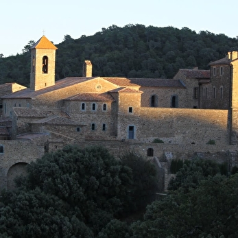
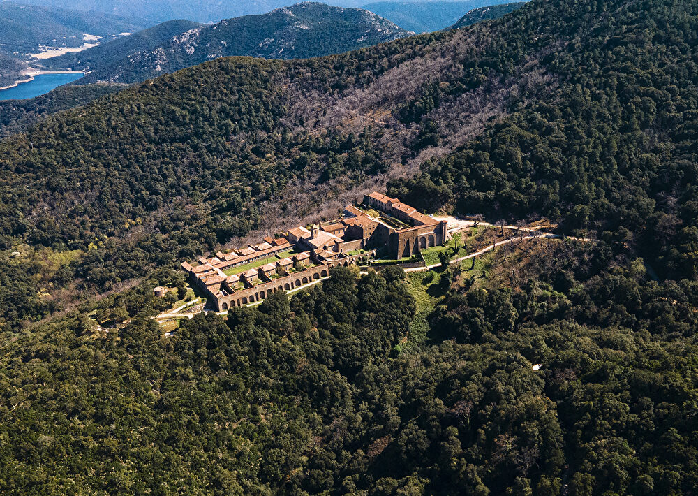
pause. You can also admire the Chartreuse de la Verne in the distance.
At the end of this descent, you will reach the RD 14, which you will need to follow uphill for 400m to reach the path on the left on the dirt roadside, which will...
will lead towards the ascent of the Chartreuse de la Verne on a track of approximately 9.5 km without any difficulty or obstacle.
Upon arrival you will be able to visit the monument and enjoy the view towards the
Massif des Maures. Then, follow the "Chartreuse 1" signpost located at the entrance to the monument towards Plateau Lambert through the undergrowth. This shaded singletrack is relatively technical with sections over rocks of varying sizes. Next, rejoin the Ragusse track on your right to enjoy a descent on a stony track for about 7 km. Consider going down below the trail to admire the cedar forest about 2 km from the signpost. Caution: this is a very technical trail with a steep descent and dense vegetation, suitable for experienced mountain bikers. Tip: leave your mountain bike at the top of the track and walk the trail.
At the end of this descent, upon reaching a small ford, take the RD road to the left for 400m, then turn left onto the path parallel to the main road. This singletrack has some small obstacles to overcome (tree roots); you have 450m remaining before returning to the starting parking lot.
- Languages spoken: French
- Animals : Not available
- Clientele: Mountain bikers, Red level - Difficult, Sports-oriented
Prices
Free access.
Schedules
From 01/01/26 to 31/12/26
- Monday : Open
- Tuesday : Open
- Wednesday : Open
- THURSDAY : Open
- Friday : Open
- SATURDAY : Open
- Sunday : Open
From June to September, before any travel in the Var mountains, check the opening conditions on the fire risk map (updated at 5 p.m. every day for the next day) or by calling the tourist office.
Contact
Start/finish: Croix d'Anselme car park
83610 Collobrières
83610 Collobrières