


Back to the list
Hiking guide between the Calanques and the hills
About
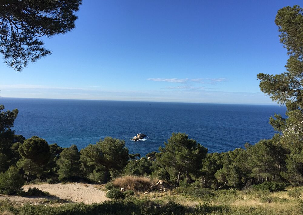
This easy route alternates between paths at the bottom of valleys and wide tracks. Following a fire some thirty years ago, a low garrigue, composed mainly of kermes oaks, rockroses, valerian, and highly fragrant rosemary, has developed on this white limestone, offering beautiful views of the Mediterranean Sea. The return journey follows the coastline along "the Lizard Trail," marked with ten information panels about the coastal flora and fauna.
Walk down Avenue Pierre Semard for about 200 meters, then turn right onto Rue des Ecoles, crossing a small white bridge. At the bottom of the street, turn right onto Chemin du Jas Vieux and follow it to its end.
Go past the barrier and through the cylindrical tunnel under the D9 expressway of the Côte Bleue. At the old quarry, continue straight ahead and up the path lined with rockroses, valerian, kermes oaks, and rosemary. It winds through a small valley that suffered the ravages of fire 30 years ago. On the ground, notice the ruts made by cartwheels, evidence of an industrial past (transporting large blocks of stone). You are now entering the hillside.
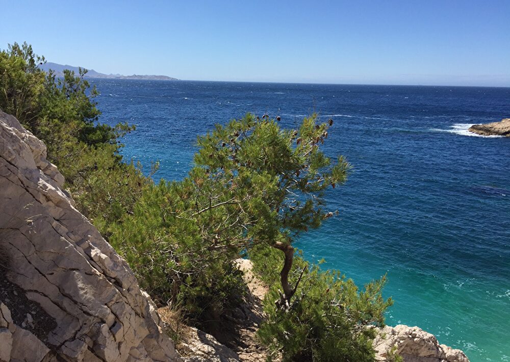
Leave the yellow trail and continue on the path to the right, which follows another small valley. Then, take the second path on the left (between two rows of pine trees). It veers left, reaches a small pass, and then joins the ridge path marked in blue. View of the sea and the village of Ensuès-la-Redonne. Follow the level ridge in a northwest direction. Pass under the high-voltage power line (to the right of a pylon).
You arrive at a crossroads (Marcel the Hunter memorial and an old rusty barrier). Turn left onto a wide dirt track (marked with yellow and blue blazes). After a pylon, take the track on the right which continues flat along the Valprête road. Follow the small yellow gas line markers for 20 minutes and you will arrive near a rusty cistern.
At the crossroads of the rusty cistern and four paths, take the leftmost small path at the corner of a beautiful pine tree. This path descends for 25 minutes into a stony, pine-wooded valley. It joins a path coming from the left. Continue straight ahead downhill (blue markers). Then pass under another cylindrical tunnel of the D9 expressway along the Côte Bleue (be careful, as it can be wet and very slippery!), follow it to the left for 100 meters, then turn right onto a good path heading due south. You will arrive at a dirt track which you will follow to the left. This track climbs alongside a telephone line (wooden poles). Stay on this main track until you reach a fork, where you will see two telephone antennas.
At the fork, with the two telephone antennas in sight, keep to the right, following the wooden telephone poles along a wide path marked in blue further down. Walk alongside the Sausset-les-Pins Canine Club. Cross the paved road and the level crossing. Continue along Avenue de Lariano, in the commune of Sausset-les-Pins, which leads to the seafront and the GR (long-distance hiking trail). Follow this GR to the left along Avenue de l'Europe D5 until you reach the Carry-le-Rouet town sign.
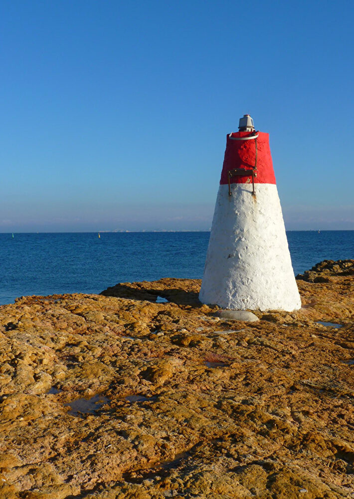
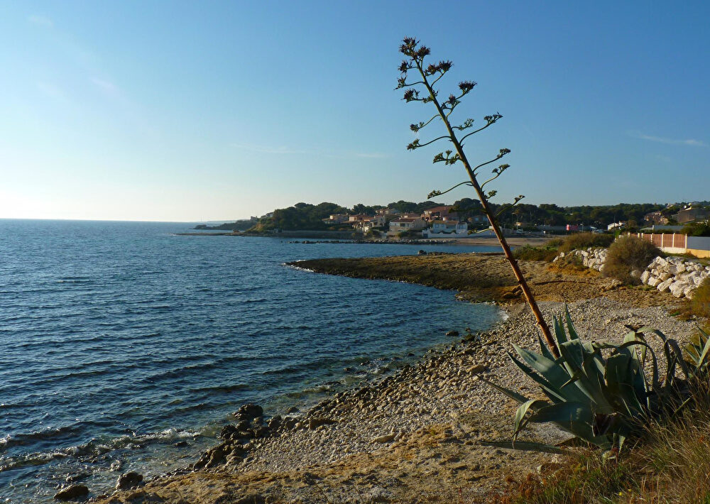
Leave the D5 at the Carry-le-Rouet town sign and Baumettes beach. Still on the GR (long-distance hiking trail), follow the coastal path along the “Lizard Trail,” which runs pleasantly along the sea to the port of Carry. This educational trail, located within the Côte Bleue Regional Marine Park, is marked with 10 information panels on various themes (aquatic flora and fauna, plants, shrubs, erosion, fossils, cicadas, and green lizards) – enough to surprise you! Magnificent views of the Côte Bleue stretch all the way to Marseille. After the charming little red and white lighthouse and the inviting sandy coves perfect for swimming, arrive at the port of Carry via the Quai Malleville and pass the Municipal Casino. Turn left onto Avenue Aristide Briand and pass the Espace Fernandel (cinema). Reach the SNCF train station by following the promenade along the pétanque court, marked with yellow blazes.
- Animals : Not available
- Clientele: Blue level - Moderate
Prices
Free access.
Schedules
From 01/01/26 to 31/12/27
- Monday : Open
- Tuesday : Open
- Wednesday : Open
- THURSDAY : Open
- Friday : Open
- SATURDAY : Open
- Sunday : Open
Except during the summer, from June 1st to September 30th, when access to the mountains is prohibited. For more information, call 0811 20 13 13
Contact
Train station parking lot
13620 Carry-le-Rouet
13620 Carry-le-Rouet
